

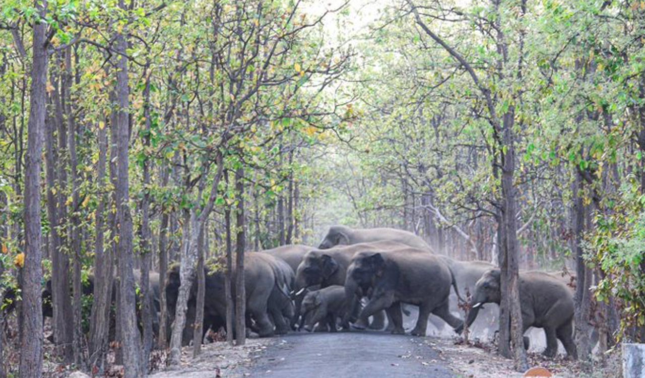
Population fragmentation poses a significant threat to endangered species like the Asian elephant, emphasizing the critical importance of preserving habitat connectivity through carefully planned elephant corridors. However, traditional methods of identifying and restoring these corridors may not always align with the needs of wildlife.

Historically, corridors have been defined as linear patches of land connecting protected areas, based on human observations and expert knowledge. However, this approach has limitations, as it may not fully consider the complex sensory world and physiological requirements of animals. Moreover, expert identification of corridors can be biased and may overlook important disruptions that hinder animal movement.
Recognizing these challenges, recent advancements in landscape ecology have revolutionized corridor planning. Rather than relying solely on expert opinions, modern approaches prioritize scientific methodologies that incorporate field data, advanced GIS technology, and innovative algorithms.
Field data, including information on animal presence, movement patterns, and genetic profiles, provides crucial insights into elephant behavior and habitat usage. Techniques such as camera trapping, telemetry, and genetic analysis allow for a more comprehensive understanding of elephant movements and genetic exchange between subpopulations.
By integrating these scientific advancements, conservation efforts can better predict elephant movement and identify optimal corridor locations. This data-driven approach ensures that corridors are strategically planned to maximize effectiveness and minimize disruptions, ultimately contributing to the long-term conservation of elephant populations and biodiversity.
In line with field data collection, environmental data can now be readily acquired on a broad scale within landscapes, either in raster format (like elevation images) or vector format (such as road maps). Scientists aim to compile various geographic information system (GIS) layers they find valuable. By utilizing raster or vector images, they can compute landscape distances between individuals. For instance, using slope data, they determine the most favorable path between two points, typically where the terrain is less steep. Similarly, genetic data aids in establishing genetic distances among individuals, which could be associated with landscape distances along the least-cost paths.
This correlation process is iterated for each chosen variable and a combination of variables. Through careful selection, researchers ultimately generate an optimal composite image known as a resistance map, summarizing resistance to animal movement in two dimensions.
The resistance map analogy is akin to a road map with speed limits: the route chosen by animals depends on road capacity and speed limits. Likewise, animal movement is simulated on the resistance map through various algorithms familiar to specialists, such as circuit theory, factorial least-cost paths, or resistant kernel, which connect animal locations and project them across the landscape. This analysis yields the final product: the connectivity map.
In the connectivity map, areas with the highest connectivity typically originate in core areas, often within reserves, and extend into the surrounding landscape, guided by the biology of the animals rather than expert assumptions. For instance, in a 2016 study published in the journal Animal Conservation, researchers developed a connectivity map of factorial least-cost path elephant corridors in the Nilgiris Biosphere Reserve.
When reconnecting two reserves, prioritizing the restoration of a “functional corridor”—known to be utilized by animals presently or historically—using analysis is advisable. Thus, a more contemporary definition of a corridor is one where connectivity is heightened, regardless of whether it lies within or outside protected areas, as it reflects the biological needs of the species, crucial for effective conservation.
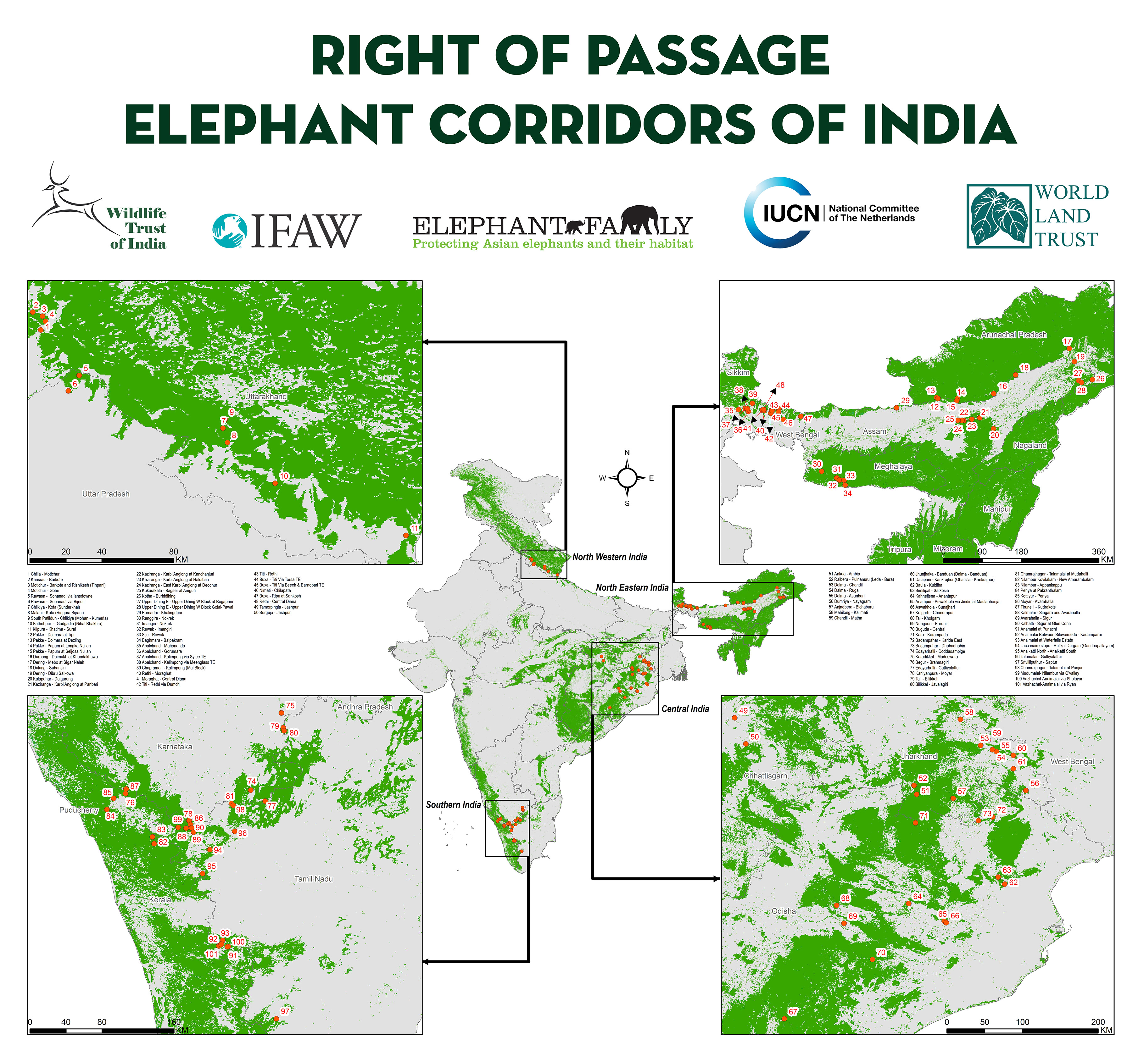
The delineation of elephant corridors has sparked debate in India. Only half of the corridors identified in the Nilgiri Biosphere Reserve according to the Report of the Project Elephant (ROP) could be verified using modern techniques. In 2023, the Union Ministry of Environment, Forest and Climate Change released another report on elephant corridors, which aimed to validate them with field data, representing an improvement over ROP.
However, during a National Board for Wildlife standing committee meeting in August 2023, Raman Sukumar, senior scientific editor of ROP, defined a corridor as “a small patch of land that provides connectivity for elephant movement across habitats, largely within a landscape of the elephant reserve” (“Elephant corridor report plagued with inconsistencies, could escalate conflict with humans, says expert”, Down To Earth website, November 2, 2023). This definition is outdated in landscape ecology, oversimplifies reality, largely disregards animal behavior, and increases the risk of accepting ineffective corridors.
Both ROP and the recent, more precise report from the Union environment ministry represent notable efforts in corridor identification. Nonetheless, it is imperative to develop a national framework based on contemporary scientific methods utilizing movement data to ensure habitat connectivity and conservation of key species.